Monday, February 28, 2011

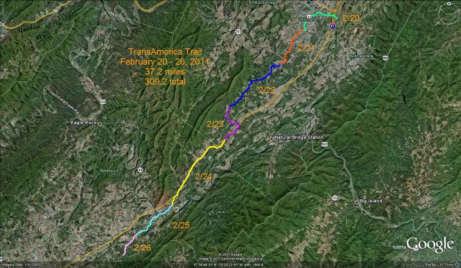
Feb 20-26, 2011

Week 10 begins just outside Lexington, VA and winds us past the small towns of Harvey and Buchanan.  While there are several small hills the elevation changes are no where as dramatic as last week.  Still pretty scenery though...

 
2-20's walk:

 Lexington has many beautiful old brick buildings.  It was also dubbed one of America's "Coolest Small Towns" by Budget Travel.  See http://www.budgettravel.com/bt-dyn/content/article/2009/09/04/AR2009090402162.html for a nice article about this city of about 7,000 souls. 

2-21's walk:
Today's walk leaves Lexington and goes through the surrounding hills.  Nothing very interesting along the walk, mostly roadside homes and new developments.

2-22's walk:

I'm not sure who Barb is, but she has a beautiful farm along the trail and has posted some lovely pictures of it.  What a great old tree in the pasture!

2-23's walk:

Looks to me like this restaurant went out of business even before the current economic downturn!

2-24's walk:

A quick change of season to enjoy a pretty Virginia snow!

2-25's walk:

On the way into Buchanan I cross the James River.  The James River was an important waterway in Virginia.  Many of plantations were along it's banks and used it as a highway for merchandise.  The James is now edged by many parks and recreation areas and enjoyed by boaters and picnickers. 

2-26's walk:


Fun again with the aerial - what on earth are these?  Parasols?  Giant Mushrooms?  White trees?


Street view shows them as a row of trees! 


Sunday, February 20, 2011

Feb 13 - 19, 2011

So, after being on the road for 8 weeks, this week finds me in the heart of Virginia, encountering the greatest elevation change of the tour so far. Between Afton, the town I begin the week in, to Vesuvius, near the end of the week's walk has a more than 2,000 ft elevation change. A good part of the trail follows the blue Ridge Parkway which meanders through the Blue Ridge Mountains.


Here's some photos from Google Earth that show the beautiful Blue Ridge Parkway:
2-13's walk (bright green color on map above):

2-14's walk (yellow green):
Part of this day is covered on horseback, I rode for an hour.

2-15's walk (dark blue):
While these mountains are not as rugged as the Rockies, they sure are beautiful!

2-16's walk (purple):
Dense trees and cuts into the hills line the roadway.

2-17's walk (gray blue):


This is called 20 minute cliff because 20 minutes after daylight strikes the cliff dusk falls.

Feb 18th's walk (pink):
So I'm cruising along on the aerial and I notice this interesting looking pattern along the road.  Know what it is?  A tree farm.  And amazingly enough someone had taken pictures of it.  The next picture is of the same farm.


Today I had 13.2 miles on the pedometer!  I spent 2.5 hours on horseback.

2-19's walk (blue green):


Another interesting pattern on the aerial.  Any idea what it is?  Again someone had taken a picture -


It's a church with a graveyard in the back - the dots on the aerial are tombstones!

Today's mileage also had 2 hours on horseback.  My meanderings took me through the town of Vesuvius and  just a little off the track is a store I couldn't resist sharing:

I just love these small town stores - they have such character!
The Start of a Journey

On December 20th, 2010 the pedometer that I ordered arrived.  I was thrilled to have it, since I had enjoyed the one I had used a couple years ago so much that I had literally worn it to death.  I posted a message on the "Bravo board" on Weight Watcher's site asking if anyone else used a pedometer and one of the gals said that yes, she did and she was enjoying tracking her mileage on a site that provided a virtual walk across America - http://exercise.lbl.gov.  I quickly looked up the link, and within just a couple moments was so captivated by what I saw that I had to join up too!  This looked like fun - using my daily mileage to virtually walk across this beautiful country of ours.

If you've spent much time around me you know that I have several flaws and one of them is that I'm rarely happy with the tools I've been given to work with. I constantly want to change or tweek things to fit what I want.  While the TransAmerica site has a series of maps and a nice tracking utility and pictures of the walk, I wanted to see my progress on a clearly defined street map.  I also wanted more information on the route.  I turned to Google Earth for this.  So I tried tracing in my route on Google Earth. 

What happened next is that I became frustrated with the website's lack of information on the actual route.  The directions and maps were vague and difficult to follow. Enter Adventure Cycling Association's Bicycle Touring Maps of the TransAmerica Bicycle Trail.  I ordered two of these, which cover the first 742 miles, and am very happy with them.  The maps are beautiful, durable and not cheap, but very detailed.  I love maps and these are really nice ones!

By the time I had the maps I was already 6 weeks into the journey, which meant that I had to catch up.  Today I am caught up with the mapping and have decided how I want to document this journey.  I will be posting a map of where my travels have taken me on a weekly basis.  I will also be adding any embellishments such as historical sites, photos, etc after the map is loaded.  So basically, checking once a week will keep you caught up with my meanderings.  Because I am behind, I'm going to start with the past week and catch up with the other weeks I've already walked as I have time.  Eventually you will see the beginning of the journey.

If you decide to try this journey yourself, let me know.  It would be fun to see how a fellow traveler is doing!

Cheers!
donna
2/20/2011